Car GPS Navigation and traffic

We’re currently reviewing our test method for Car GPS, both standalone devices and smartphone apps, as we have a test scheduled for later this year.

If you currently use a navigation device or app that features traffic data functionality, I’m interested to know whether you find it beneficial. Does it help re-route you around traffic jams, or is it more of a hindrance ? Does it suggest pointless detours that divert you temporarily, only to then suggest a right turn over three lanes of a traffic at an intersection without traffic lights ?

This is also a shout-out to any members in the Sydney area that may like to be a triallist in our test. We have not done a user trial in the past, but are considering one for this year.

We’re also open to any general suggestions you might have on the subject of GPS for motor vehicles. ( We do include a brief test to determine whether they may also be suitable for cyclists, but bicycle GPS are essentially a separate category )

You may want to read some of the responses to this post as well:

4 Likes

If you can’t talk it through all commands and it can’t respond verbally then it should be banned in vehicles. Period.

It’s bad enough that people speedo-gaze due to the draconian, ambiguous and largely unreasonable laws on velocity (when considering the training and accreditation requirements for motor vehicle operation), let alone all the other electronic distractions.

:slight_smile:

4 Likes

I use Google Maps, and I do rely on the traffic updates.

Where we live the M1 is one of the two primary traffic arteries for North/South traffic.

In non-peak hour if there is anything out of the ordinary like a car pulled over, it becomes creapy-crawly. Twice every day it becomes a short stay parking lot. If there is an accident, or there are roadworks during peak hours it becomes a long stay parking lot.

Sometime there are alternate routes that can be used. On one trip to Brisbane Google maps rerouted me through four toll gates in under 20kms so I could get to an appointment on time. Expensive but I got there on time!

When I am not in a rush, I just ignore the alternate route suggestions and plod along.

I have had my share of wonderment at the directions. On one trip to the country Google maps directed us to drive past our turnoff, do a u-turn drive past the turn off, do a u-turn, and then it directed us past the turn off again before I decided there was no emergency and would follow the signs instead. Other times it wanted me to turn where there was no street. I wondered how one house fared being located in the middle of a Google road. It must have been very drafty as imaginary cars drove past.

So to me, even with all the stuff ups, maps with the traffic information is absolutely essential.

6 Likes

I have a Garmin with supposed live traffic updates. In greater Melbourne I find it laughable as it is so random. I have yet to see it do a reroute because of traffic.

4 Likes

I always use Google Maps for my weekday commutes to and from Melbourne; indeed for all but short local trips to familiar destinations such as the supermarket.

Although I’m extremely familiar with the main routes, the real-time traffic data provided by the navigation aid is invaluable. The ETA provided at the outset of the 50km trip is highly reliable (often to the minute), except where an incident occurs during the trip, in which case the dynamically-updated ETA is very useful.

In the event of incidents causing significant delay, the suggested detours have, by and large, been extremely useful and have taken me along curiously efficient back-street bypass routes.

However, there have been a couple of exceptions; notably recently when I exited a car park onto Flinders Lane. During the evening peak, the traffic jam starts on level 3 of the car park and it takes 20 to 40 minutes to move through the car park to street level. On exiting the car park, I would ordinarily slowly make my way south but, on this occasion, Google Maps suggested a left-turn city block circuit with the proposed route ultimately heading south on Spencer Street. It was all looking rather promising for a CBD exit to South Melbourne when I discovered that, in reality, Spencer outbound lanes were closed due to road works. This roadblock was not “known” to Google Maps. By the time I discovered the fact on Spencer, the only option available was to turn into Flinders Lane again. Hence, fifteen minutes after exiting the car park, I found myself back in front of the infernal car park, back in gridlock.

Using Google Maps, I love the fact that I don’t need to know the address of my destination. If my target is a business I’ve not visited before, I just provide a voice instruction to Google to navigate to the business name in the suburb, and the navaid automatically derives the address and plots the route. For a destination which is in my phone contacts, I just voice the contact name as the destination and Google derives the address from Contacts.

During peak hour, the main arterials around Melbourne and inner suburbs are a dogs’ breakfast. Google Maps tells me in advance if there’s an incident on the M1, in which case I use Google Maps to get an ETA for the alternative route. If the differential is less than 10 minutes (it often is), I avoid the tollway. Why pay a toll if there’s no significant time benefit?

I love the technology. It’s brilliant and has generally been a real time-saver. My mantra with Google Maps has become: “put your faith in the machine”, and I routinely put my faith in the machine. The app is free and I can pre-download maps when connected to my home network. I am on a low-cost mobile phone plan and my map usage does not exceed the data allowance on my plan.

In the days when I had an after-market Android phone brand with inaccurate GPS, the navaid was highly inaccurate - as a byproduct of the phone’s appalling GPS. I upgraded to a Samsung Galaxy a few years ago, and now would not be without Google Maps for most trips.

8 Likes

Couldn’t have said it any better
My 2yo Subaru navigation provides great instructions but the ETA is always wrong. So i use Google maps too

5 Likes

I found for a very long time my factory fitted GPS in my Toyota was constantly sending me the wrong way so didn’t use it. After some time I told the dealer and after looking at it they said I needed a new DVD to upgrade it- cost $350. $350 I said I could buy a whole new unit for that. Haven’t bothered and just use a map.

6 Likes

20 minutes, maybe 25, is my entire 35 km commute to work … wow …

3 Likes

draughtrider, you have the dream commute. Mind you, if I was driving a Tesla S rather than my old combustion-engine Ford, I wouldn’t mind crawling - nay, gliding - through the peak-hour congestion!

6 Likes

I use Google maps quite a bit, often whilst walking, but sometimes when in a car. I find it often sends you to the wrong spot for certain places like shopping centres or hotels. When in a car last week, it sent us to the front entrance to a shopping centre, instead of the car park in the street behind. It was difficult turning the car around to get out of the wrong dead end street and I noticed a couple of other drivers go up there, even though the next street had the parking sign (they obviously used Google for directions). When walking, i’ve been taken to the rear of hotels where there are car park entrances. It knows i’m walking so should send me to the street with the main entrance.

5 Likes

I use a TomTom GO6200 every weekday for traffic. Results vary. I’ve found that there’s a sweet spot for re-routing to avoid delays. If the unit suggest that it can save <10 minutes, then I don’t bother. Quite often, by the time you and others try to re-route, any potential time savings get lost at the next bottleneck. However if the saving is >10 minutes, then the suggested re-route can be worth it. Sadly, it also pays to cross-check the re-routes with Google Maps as quite often the TomTom is wrong. Despite regular maps updates it still has issues with alley ways, dead end roads and no right turn intersections (particularly variable ones).

7 Likes

I’ve two Garmin GPS units with Lifetime Traffic (not Live Traffic which links to your phone) updates in my cars and use them all the time when I’m driving. It doesn’t require connection to the internet so works without a phone or WiFi hot-spot in the car. They seem quite accurate with travel times and traffic conditions.

3 Likes

We’ve used Garmin units since 2004. Really like the lifetime map updates, lifetime traffic (requires use of particular power cord for the traffic receiver), spoken place names, putting in our own custom points of interest, etc.
Our latest Garmin is a seven (7) inch screen DEZL model (designed for trucks, motorhomes, vehicles towing caravans, etc but great to use in an ordinary car) with reversing camera (later DEZLs can also have dashcam included).
Hopefully Navigation in the Tesla will catch up with types of features that Garmin et al have - such as - setting multiple journey points before you start off, offering a visible choice of routes. Navigation in the Tesla is like Google Maps and the Garmin device in that it will pick different routes depending on time of day & day of week because of traffic patterns.

2 Likes

This could be a bit of fun - coordinates are so old school :wink:

While it sounded initially strange to me, it’s actually quite fun, and the three words concept works fairly well and a lot easier to remember … given its a 3x3m square you can pick and choose a cool name from a few, unless you live completely within a 3x3m square …

“please take me to pledge canned blissfully”

… blissfully indeed, a stunning red …

Of course, in true insular style, these guys have used English words for the whole planet.

… happens to be in China …

2 Likes

Not strictly true. I’ve got the app on my phone, and it supports many languages. As an example, I’m sitting in the Chris Ruggles Sound Lab, and my address in Japanese is ///tsumikomu.boueki.natta :grin:

It translates to squeezing.foreigntrade.became

4 Likes

More than just fun, too. Emergency services have started to ask people who have become lost ( and have a phone with reception ) to use it, so that rescuers can home in on an exact location.

4 Likes

IGNORE GPS
FOLLOW SIGNS

I wonder how long each GPS provider takes to update in response to major road upgrades and intersection changes?

Anyone travelling the M1 north to Caloundra or The Sunshine Motorway in the last week would have seen the above roadside announcement. Those roadside illuminated message boards can be quite informative.

Major roadworks have been ongoing for more than a year at both these critical road junctions. It’s an interesting observation that this message has only recently appeared. That’s in difference to altered lane choices and turning off location changes occurring progressively. Roadworks speed restrictions remain in place.

P.S.
An interesting challenge for semi autonomous Google and Uber trials. Those sudden hand back to driver, there is no road or line markings here situations might not go too well.

3 Likes

Most roads in Australia don’t have line markings…only the major connectors, high traffic routes and highways. Off these roads, the road network is often narrow, often gravel and in locations where GPS doesn’t often work…shadows of trees, mountains etc.

1 Like

Yes the GPS navigation app built in to my car does re-route around traffic jams, and does it very well (and will keep doing it throughout the journey, not just at the start). I think it has superior route alteration to that offered by the WAZE app on my mobile phone.
And they are both better at re-routing around traffic jams than my Garmin DEZL satnav which has “live traffic data” feature, and better than Google Maps app on my mobile phone.

1 Like

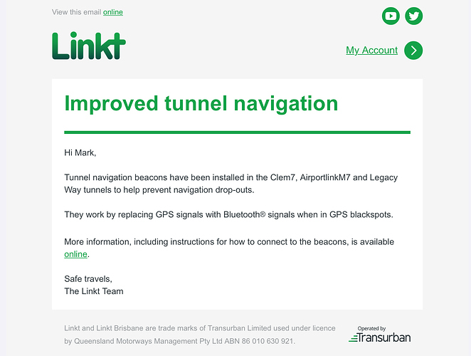
One more place the GPS might now function. Although it foregoes GPS for Bluetooth connectivity. How many GPS devices actually have this capability and will do so promptly, reliably and without user intervention?

Something to add to any future Choice testing of GPS software or devices.

1 Like