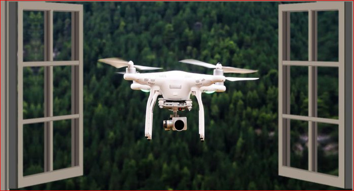
It has been reported that law enforcement units have used drones to catch perps, and it has come to attention that local councils are now using drones to have a look at people’s properties, take photos, and issue fines. Three of the (for me anecdotal since I am not privy first hand) stories are (yes, they were breaking various laws and restrictions, but):
A drone photo showed a family had a kiddie inflatable pool. The council gave them 1 day to drain it since it did not have a fence and gate.
A drone photo showed a family made an apparently illegal (unapproved) dam on their rural property and were given a $30,000 fine and ordered to remove it.
A drone photo showed a family had blackberries growing on their property. Apparently they are noxious weeds and the council gave 1 week to eradicate them or be fined.
Since the drones are obviously being flown by local government over and perhaps into people’s private property, no telling what photos they might be taking or whether there is any care about privacy laws. Then private enterprise and amateur flyers? Drones are relatively new and largely uncharted legal territory, and as with anything new they have promise but also frighting aspects from invasion of privacy to noise noting some are quite loud.
Big brother is increasingly upon us. And lets have none of that ‘nooky nooky’ in the back garden either! This is making google earth and street view looking more innocuous every day.
There are different requirements for commercially operated drones (which is likely the regime Councils operate) and recreational operated drones. It is likely that Council is licensed and has certification for its drone operations.
If I was issued a infringement notice from a Council as a result of drone surveillance, it may be prudent to ask for information about the drove’s operation to ensure that its operation was lawful and met CASA requirements.
I suppose that it is no different to the Police helicopters which fly over and take footage of incidents or for reconnaissance purposes.
Most Councils also operate and investigate when they have received a complaint (this is the case for many large Councils such as Brisbane City Council). It is possible that the examples you had given were investigations as a result of a complaint rather than Council drones surveying backyards to see if there were anything unlawful occurring. Such questions can be asked of Council if an when an infringement has been issued and received. Unfortunately parties not subject of a specific infringement can’t gain such information due to privacy concerns.
As often is the case, there are issues in life demanding conformance to laws that are sometimes quite well thought out and drafted, but sometimes poorly thought out, arbitrary, and badly drafted, and everything in between.
My point remains. Consider the kiddie pool. Perhaps an aggrieved neighbour whose child attended felt it was a safety problem and the pool owners disagreed? Would council require a FOI application to reveal whether there was a factual complaint and who lodged it or whether it was a random fly-over? Can a council drone flying toward a ‘complaint’ notice you might be watering your back garden during water restrictions and fine you?
We don’t need to belabour the ‘what ifs’, they do not lessen the potential or possibly shield the reality of the impacts of a drone monitored life.
And don’t forget that the Chinese government MAY be getting access to all the data from the DJI and other Chinese drones; Huawei comms equipment; Hikvision, Dahua, and other security cameras, all via ‘backdoor’ feeds.
Noting it is not unique to the Chinese government, and the Chinese government (or US or an EU or Asian one) could be ‘downstream’ from those council flyovers, especially in a certain area near Alice
Councils have been using aerial photography for decades to track new structures/etc. I imagine like many things drones simply make it more ‘on demand’ and nearer real time than the old once every year or two aerial photographic surveys. I’d not be surprised if there is some use of the various search/mapping technologies as well - street view, google sats.
I’d suggest never to point a camera anywhere you don’t want others to see - if its your driveway or shed, maybe ok - but not above your shower exhaust fan or next to the mirror on your bedroom ceiling
We’ve never had it - the only difference today is that our complete absence of privacy is in full HD or better, with surround sound …
The respective governments aren’t the ones I’d be concerned about - it’s Gerry Harvey, Koges, and the banks !!!
Councils don’t need to use drones as they regularly update their GIS systems which produce high quality geo-mapping images for any enforcement activity. This has been the case for well over twenty years so I doubt the use of drones adds much value to their activity. Legally, drones must be flown within operator line of sight within prescribed low altitudes and are regularly used by real estate agents to produce bird eye images of for sale properties. I would imagine this is the reason why people see drones over residential areas from time to time. Realistically, while Councils may use drones for some purposes, they would be relatively few as the GIS systems can be viewed on demand without the bother of complying with drone regulations.
Back in the 1990s the building inspector around these parts had a pilots licence, so the aerial surveys to check on building activities were rather common on weekends! He did upset a lot of people…
The Commonwealth through CASA regulates use of air
space, primarily for safety of operation.
Individual privacy, civil amenity, property rights are with the states and local councils. Many local councils have set out to manage the impacts of drone operations.
One view is this may be an issue that involves constitutional law. Where a drone is launched from, councils have considered as under their legal control, however once the drone is airborne the drone is in Commonwealth airspace!
In the ideal world yes; These three were from the partner’s personal contacts who were the individuals cited, so I am one person removed so for me it remains anecdotal, although trusting the individuals concerned. However, it appears the photos could have been from other than drones.
There is no reason to doubt the related information.
The incident re the blackberry does not relate what may have happened prior. I’m personally aware of far worse similar directions from several councils. They have however all been preceded by education and fair warnings. Perhaps this information has lost some earlier detail along the way which increases the effect. Or the issuer was a frustrated ex parking enforcer?
Of Note:
The council I have regular contact with appears to have significant powers of entry in the instance of carry out duties. Similar to the electricity meter reader person. There are conditions and legally something I don’t quite follow that refers to residences and or premises with some distinction between the two. In some instances they are the same, in others they appear to be different!
Nearmaps is a very powerful tool, however a drone no doubt provides a more immediate view.
The regulation and legal management of drones or drone like technology in our society may have moved another small step with the realisation that there are limited legal limits on direct enforcement! Communications legislation vs CASA?
A ban on police pursuits and the removal of number place or ID from all motor vehicles might be a similar scenario?
P.S. Simply put the operation of scanning equipment to detect drone control signals, position of the drone or controller need legislative amendment due to restrictions explicit in legislation on possession and use of such equipment. Using tech to interfere with or take control of a drone also requires changes to legislation. Even the law has to operate within the law!
ACT Policing said anyone with information about the incident should contact Crime Stoppers on 1800 333 000, or via the Crime Stoppers ACT website.
So many unsolved crimes … oh dear. I can help - I read the article - people at Crime Stoppers, the information you need is right in front of your eyes:
It is understood Evoenergy was using the drone to carry out surveying work when it was shot down near Apollo Road, and that local landholders had not been notified of the surveying work.
Speak to Evoenergy. I’d suggest the person operating the drone is lucky to be safe and sound …