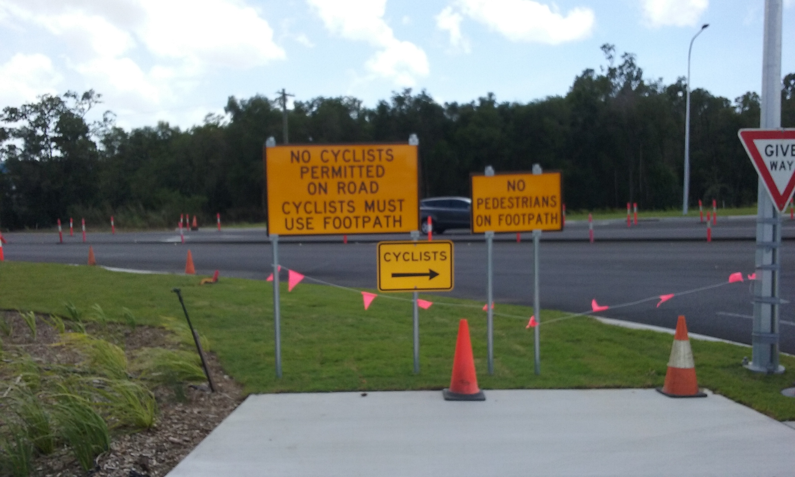
Whilst driving to buy some seafood this morning, I spotted the signs below at the intersection of the Southern Access Road aka Portsmith Road aka Ray Jones Drive and Lyons Street.
I have looked at this a few times, and tried to think of some way this could make sense in some way, and have failed. Perhaps this could be submitted to the writers of the ABC show Utopia.
To be fair, I suspect that these roads are local government (council) jurisdiction, not state government (TMR)
Still, that signage is hard to make sense of!
The original Armco guard rails in areas of FNQ comprised a single rail with the bottom well above the ground.
Many have been upgraded with a second lower rail fitted to prevent motorbike riders going under the top rail in an accident, but the second rail is still clear of the ground so small creatures can still get under them.
After a mere 2.5 years, the ship of fools has “almost completed” the road upgrade to add a single extra lane in both directions despite their unbelievable incompetence which has seen 2 of the 3 lanes in both directions blocked on an almost daily basis whilst they have pussy footed around fiddlying with trival matters in addition to ripping up and relaying 3 lanes of new asphalt roadway.
They have even removed these signs so one can only assume that pedeatrians are now permitted to walk on the footpath despite no signage confirming it or just where they were supposed to walk previously.
Perhaps one day they might even remove the 60 km/h signs so that motorists will once again be able to drive at 80 km/h like they could some 3 years ago.
When this road was originally built as a single lane in each direction, constructed over the old Council landfill dump, the middle part was posted with a 90 km/h which was subsequently reduced to 80 km/h after some fatalities.
After it was duplicated years ago to dual lanes each way, the 80 km/h limit remained until this “three ring circus” took over.
I only saw a couple of speed cameras along the road during the latest “construction” so the Police did not use it to maximise revenue, but as the traffic was moving so slowly most of the time, that was not surprising.
After the second dual carriage way was constructed, they reconstructed the first dual carriage way which had badly subsided and could almost make motorists feel sea sick.
Some years later, the new dual carriage way became even more subsided than the original carriage way was.
Some weeks ago, the second dual lane bridge was demolished after the first dual lane bridge had the lanes raised higher to meet the new height of the road.
The only thing that this ship of fools managed to do was to actually place fill at around 2 metres high so as to try to ensure the mud and the swamp actually had compacted enough so as to possibly ensure the previous subsidence problems with the previous stages.
FWIW we have a local roundabout removal taking all of 2021 and 2022 and the lanes have been routinely shifted, closed, and opened, with the temporary speed limits defying common sense with 60 kph going into a narrowed single lane with barriers on both sides, then at the end of the barriers it reduces to 40 where the roundabout once was, and after all construction is passed it remains 40 for another 1km.
Maybe TMR Qld and Vicroads have been cross pollinating?