has a number of links, one being verification of addresses API. Asking the development support group how to proceed for corrections that are ignored might get you a direct shortcut, or become another black hole, but worth a try.
Provided that Council is the naming authority in your state/territory (which I don’t think you have mentioned).
Even so, let’s say that Council is the naming authority then they would have to provide the information online so that Google can verify what you are saying.
Australia Post is not the naming authority. However they do provide a database that is available with quarterly (last time I checked) updates at a reasonable ongoing cost (well, reasonable for a company the size of Google) and that covers the whole of Australia. So it is not beyond the realms of possibility that Google uses that database - as being more convenient than a bunch of crappy Council web sites with inconsistent user interfaces / user experiences in states/territories where Council is relevant.
Indeed. (There are cases that I am aware of that are decidedly in the “or worse” category.)
And it is an example of the more general problem of “computer says no” / “algorithm says no”.
For online purchases it would only be an issue if the same postcode had a XYZ Court and a XYZ Cresent.
Australian postal services will still deliver with partial addresses only being correct. They even get delivered when mail is lacking a street address (when they exist) - we often have mail delivered which only has the property name or incorrect address details.
What does Australia Post think your address is? Pretty sure that’s where most datasets originate. You can check your “official” address through one of the service providers like Experian here: https://www.experian.com.au/business/solutions/data-quality/customer-data-validation/address-validation#validationtrial and see what that gives. Once you’ve established what’s “official”, you just need to draw other authorities’ attention to the correct info with a link to that source.
In most states it is the local government which establishes street numbering and addresses. This Queensland Government website explains local government’s role:
and states:
It should be noted that local governments are the recognised authority for allocation and approval of road names and numbering.
The information/datasets from local government then feed into state government land information systems and are used within Australia as the ‘approved’ address.
Google (and Apple Maps) works differently where users have the ability to correct and change information on their mapping system. This means that errors can be fixed, but can also cause new errors if the amended information isn’t correct. This appears to potentially be the source of the problem highlighted in the original post.
You will eventually get a response from google just persevere, Bing or Microsoft will not respond to a individual to correct their maps. In my experience.
On your web browser on a PC visit Google Maps and locate your street. Open the top left menu and select Edit the map; Add or fix a road. Follow directions.
Persist. I think that only 3 of my first 10 edits were accepted; now, most go through.
Do an edit with the app on your phone; include photo of street sign
Do edits on Google maps, Waze, Apple maps, Bing maps at the same time.
Get others to do the same, so edits do not come from the same account.
Be brief: ‘Smith Court [NOT Circuit] as indicated by street sign photo, council and land title documents’ - don’t rant.
Remember that Google and the like are wary of mischief makers.
Another thought, having completed a lot of Google Map Edits, is to ensure you have a Gmail address when editing Google Maps. It’s free and possible useful in other ways (use it for subscriptions and belonging to Retailers etc).
Anyway, before you make the edit to Google Maps ensure you open Google Maps using in Google Chrome Browser and have signed into Google Chrome using your Gmail address and then followed the following:
As irritating as it might seem, Google Maps is not the authority on lot locations or street/property addresses. The advice so far will be helpful to some.
Possibly the greater concern is when one needs to call an emergency service. In that instance, which resource does your local ambulance, police or local member of parliament go to, and how is your property access point identified on the mapping they are using? Hopefully for those trying to get Google to update their maps, the local fire brigade is not reliant on Google?
More an issue for us non urban dwellers. But can be an issue as others have posted for those who have close neighbours too!
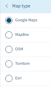
what3words uses Google Map layer as default, but it also allows selection of other mapping systems, namely:
It would be interesting to know from @Kathel, whether the naming convention error exists on these other mapping systems (if they have coverage for the area in question).
We live in a rural setting and run a BnB. We find that many of our guests end up at our neighbours’ house because Google Maps identifies where our house is rather than where our driveway (200 metres long) begins.
Then perhaps you could approach Google Maps with a map update that adds your driveway, if that would help to get customers to your door. This should be particularly easy if the driveway is clearly visible in the sat view (which it may not be! is it?).
Can’t find on MapBox without subscribing; likewise TomTom and Esri. OSM lists the correct address, as does WhereIs. Our car GPS (Mazda) also lists the correct address.